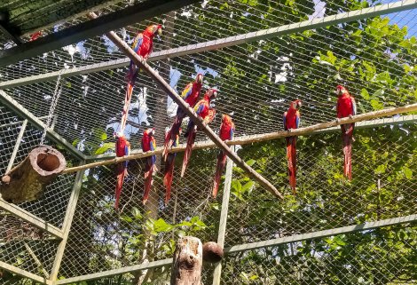
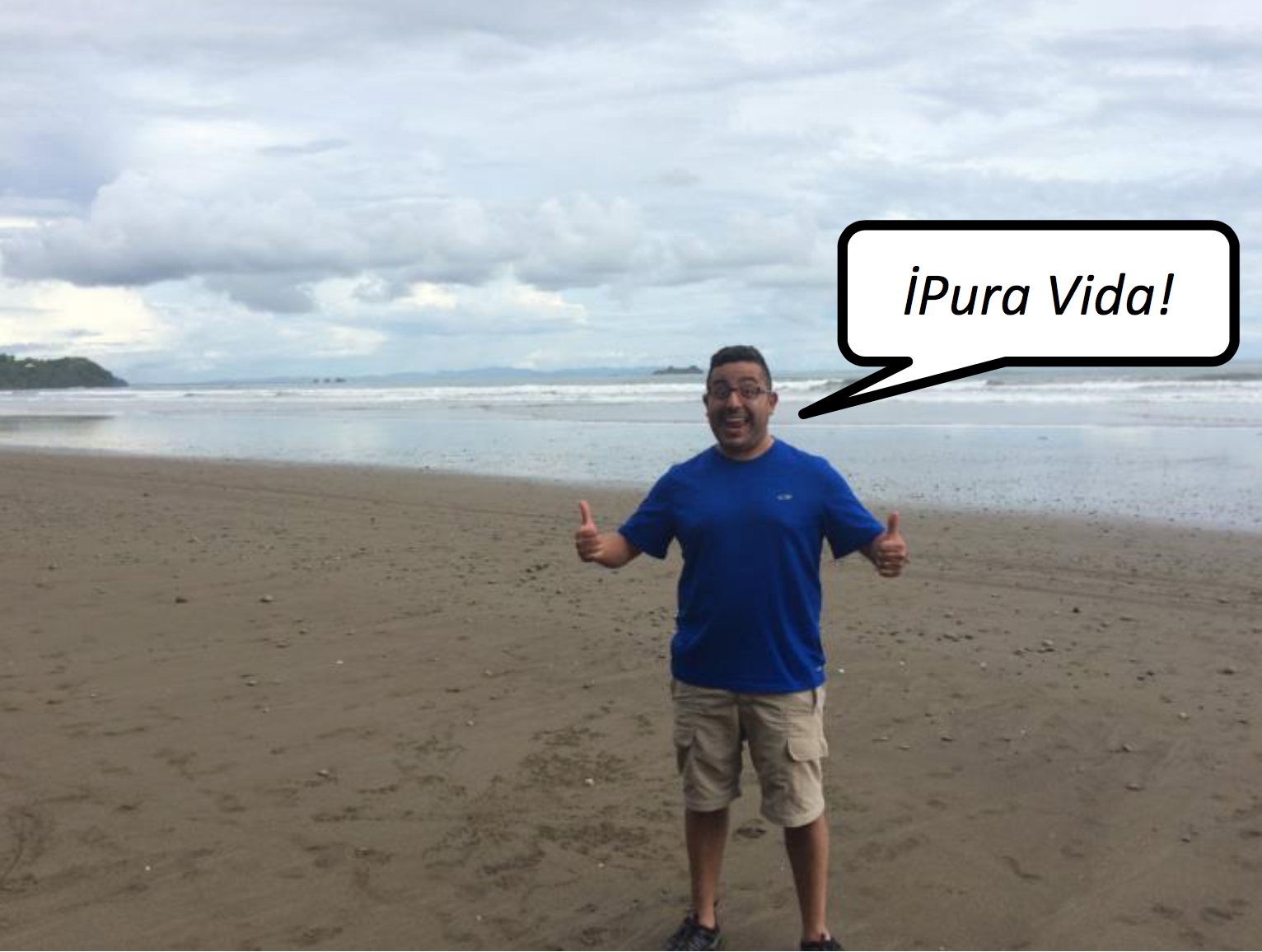
This social flock of scarlet macaws bonds with each other as the birds are readied for release back into the wild. (Photo by Zynnia Peterson)
Chance to Soar
Ohio Wesleyan Zoology Major Volunteers to Help Parrots in Costa Rica
By Cole Hatcher
Zynnia Peterson ’23
Name: Zynnia Peterson ’23 Hometown: Mt. Vernon, Ohio Major: Zoology Minor: Environmental Science OWU Connection Experience: Volunteering with the Macaw Recovery Network in Costa Rica
Peterson volunteered with the Macaw Recovery Network’s Punta Islita Breeding Center for a month this summer. After she completed training, Peterson was able to help prepare food for captive and pre-release parrots, monitor their health and behavior, and ensure they had clean and safe living conditions.
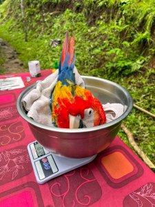
This macaw chick gets a check-up at the Macaw Recovery Network, including being weighed. (Photo by Keiran Ragoonanan)
Readying for Release
“Something I learned specific to parrot conservation is that human aversion and flight training are absolute musts when preparing a flock for release.
“Parrots, being more gregarious birds, can become used to humans in captivity and this can increase their likelihood of being recaptured after release unless they are taught that humans are actually scary, even though not all of them are.
“Flight training then also increases their strength and ability to fly long distances once released as well. A lot of it is just about promoting natural behaviors that parrots learn from other parrots and their environment. Since they’re more intelligent, they have to be taught these things through experience rather than via instinct alone.”
Valuable Volunteering
“I also learned that volunteering is a good way to travel. It gives you a group of like-minded people that you get to know really well as long as a safe space to go back to while you still have the ability to explore the local area on your days off.
“While I didn’t immerse myself in Costa Rican culture as I had hoped, I still had the opportunity to meet amazing people from all around the world and form close friendships.”
Identifying What’s Important
“My experience also helped me relax a little bit. I feel like it’s easy to get caught up in the busy lifestyle most Americans have, but being in Costa Rica and only having to worry about a bit of food management (we only drove to the grocery store once a week) and whether I had to do specific chores that day really gave me a new perspective on what I actually viewed as important.
“By the time I made it back home I was able to create new habits that serve me better than some of the wasteful and unpleasant habits I had before.”
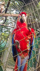
ET is one of the macaws Zynnia Peterson ’23 helped to care for at the Macaw Recovery Network. (Photo courtesy of Zynnia Peterson)
My Favorite Moment
“Even though the purpose of my experience was to learn more about conservation, I would have to say my favorite moment was the night before a fellow volunteer was about to leave. She taught us all some Latin dances and then made Argentinean empanadas.
“Something I unexpectedly loved about my trip was how close you get to everyone on site, especially during our communal dinners. Everyone I met was an absolutely lovely human being, and I hope in the future we can someday meet again.”
Beneficial Bishop Encounter
“Unexpectedly my trip did involve an OWU alum. On my plane to Miami, I sat next to Mrs. Marcy Rodgers. She graduated (in 1982), and we were able to chat a lot on the plane and during my layover. She has a lot of experience traveling in Latin America, and she was very helpful and calmed some of my worries about traveling.”
Why I Chose OWU
“I chose OWU because of their affordability with GLCA (Great Lakes Colleges Association), smaller size, easier ability to connect with staff due to the smaller size, as well as their Zoology program.” (Ohio Wesleyan is a GLCA school, and Peterson’s father is employed by another GLCA school.)
My Plans After Graduation
“Until this summer, my future plans were to work in zoology with hopes of improving the pet trade for exotic animals like reptiles and parrots.
“I have been recently looking into requirements for science librarians due to my very enjoyable part-time job at my local public library, which complicates things a bit as far as the experience in conservation.
“No matter which path I choose, I think OWU has prepared me for either with skills in writing, networking, and the ability to work with others from different walks of life.”
DELAWARE, Ohio – Ohio Wesleyan University student Janelle Valdinger is one of fewer than 20 undergraduate and graduate students across the country invited to participate in January in the first national Workshop on Community Geography.
Building Community Through Geography
Ohio Wesleyan Student Earns NSF Funds to Attend First-of-Its-Kind Conference
DELAWARE, Ohio – Ohio Wesleyan University student Janelle Valdinger is one of fewer than 20 undergraduate and graduate students across the country invited to participate in January in the first national Workshop on Community Geography.
Valdinger, an OWU geography major, has been named a Community Geography Fellow and awarded funds to attend the two-day conference Jan. 25-26 at Georgia State University in Atlanta. According to organizers, the National Science Foundation-supported workshop will bring together 40 to 50 Community Geography Fellows, who are “academic researchers and community leaders interested in using geographic research for community development, social justice, and environmental sustainability.”
In addition to being a full-time Ohio Wesleyan student, Valdinger also is a full-time employee of the City of Delaware, where she works as a Geographic Information System (GIS) technician.
She said her main goals for the workshop include “learning new ways to use geographic research for community development, especially in other countries … and finding new ways to build a stronger, long-lasting working relationship between Ohio Wesleyan University and the City of Delaware.”
Valdinger already has helped to coordinate a joint university-city project to install three water-purifying rain gardens on OWU’s campus. She is helping now to implement a collaborative relationship that involves the city’s Department of Public Utilities hosting OWU students as interns and “developing a partnership with the OWU Summer Science Research Program where the city hires a student-intern for the summer and the university provides housing, along with faculty guidance for a research project.”
The first Ohio Wesleyan student to hold the summer research internship is junior zoology major Brianna Graber. Graber is working with the city this semester on a project to fund and install storm-drain nets to catch large waste items and prevent them from entering the Olentangy River.
While attending the Georgia conference, Valdinger will present information on the developing OWU-Delaware partnership, which currently includes eight university students working on environmental projects.
In addition, she hopes to glean information to assist with her Ohio Wesleyan departmental honors project, which focuses on mapping public utilities in Belize.
On campus, she is collaborating on the honors project with Department of Geology and Geography faculty members John Krygier, Ph.D., director of environmental studies; Nathan Amador Rowley, Ph.D.; and Ashley Allen, Ph.D., and with Jay Scheffel, assistant director of physical plant. Off campus, Valdinger is working with 2003 OWU alumnus Tim Hawthorne, Ph.D., assistant professor of GIS at the University of Central Florida.
“Not only will we be mapping utilities, but we will be providing utility locators to the local government officials in Belize,” Valdinger said. “Citizen Science will play a large role in this project, and learning (at the workshop) about what avenues other professionals have taken will help greatly in the execution of my project.”
Krygier, who was also named a Community Geography Fellow, said he is excited for Valdinger to attend the workshop and share her OWU accomplishments with scholars from across the country, and to learn how to further community engagement on campus, in Delaware, and abroad.
He also is excited by the overall potential of community geography, one of his research specialties, and its focus on engaged community work.
“It’s about creating a win-win situation for colleges and their communities,” Krygier said, “with positive impacts, research experiences, and real-world engagement between people and institutions who share many common goals.”
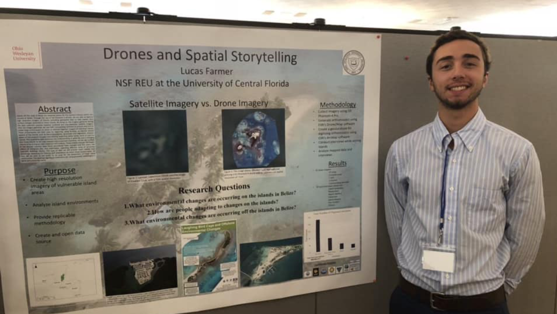
Presented at the ELDAAG Fall 2018 Regional Division Meeting, Ohio Northern University
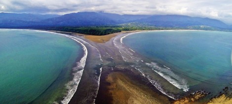
Using DJI Phantom 4 drones, we captured high-resolution imagery off the coast of Belize. This provides geospatial data to help explain observed land surface changes. Imagery gathered during the data collection process replaces outdated and low-resolution satellite imagery. We use ESRI’s Drone2Map software to process data and create orthomosaics of individual islands. These orthomosaics are used for digitizing to identify several aspects of the islands. We interviewed locals that either reside, work, or visit the islands. After analyzing the latter information, some themes include: how island boundaries have changed over the years, the effects of mangrove loss, and information on structures (seawalls, buildings, docks). All data is open to being used for the betterment of these island communities. The work has significant implications for using geospatial technologies in Belize and globally, to provide much needed local knowledge on the impacts and adaptations of these islands.
First of all, the Environmental Studies Program is no longer a thin after our proposal for an expanded Environment and Sustainability Program was voted into existence at the May 2017 faculty meeting. The proposal was compiled by a group of faculty, Laurie Anderson,Ellen Arnold,Amy Downing,Chris Fink, and John Krygier, drawing from 5 years of efforts. Additional work on the Environmental Science major was done by Bart Martin.
Information about the program has been added to the OWU web pages:
Our proposed OWU Campus Sustainability Plan created by students, staff and faculty over the last few years is just about in its final form and should be heading to the administration this summer.
Student Emily Howald has spent the year gathering feedback and making adjustments to the plan. The Sustainability Task Force (STF), initiated in 2008, has overseen the development of the plan. Contact Nathan Amador and let him know if you want to be added to the STF mailing list. The STF is open to all.
Student Emily Howald and faculty member John Krygier wrote a paper which is to be published as a chapter in the book Sustainable Communities Design Handbook edited by OWU Alumni Woody Clark (OWU 1967). The book should be published by Elsevier in 2018. The chapter is an overview of OWU’s approach to sustainability, called “Scrappy Sustainability at Ohio Wesleyan University.” Clark was recently presented with an OWU Alumni Distinguish Achievement Award.
The 2017 May Move Out was another success. Students donated tons of items to Goodwill as they moved off campus last month. The event, first held in 2012, is at this point relatively easy to manage and does not cost the University any money (the cost of additional storage pods for donations is offset by the need for fewer trash dumpsters).
Our reusable carryout food container program is also relatively stable after some ups and downs over the last year. We have added drop off locations for the containers, increased their size, and decreased the size of the paper, throw-away containers (thus an incentive to use the reusable containers). Students Izzy Sommerdorf and Sarah Hanes have developed a proposal for making the program even easier for students, and our campus food service, Chartwells, is evaluating their proposal.
Sustainable food on campus has moved forward on several fronts. Our campus food service has recently worked out an agreement to purchase local produce from the Seminary Hill Farm, just south of campus, beginning this fall. This outcome is based on the efforts of student Ellen Sizer.
Student Emily Howald is working on a proposal for quarter-credit OWUActivity courses focused on gardening. Students would work with a skilled gardener in a course held during the first half of the fall semester, and second half of the spring semester, to maintain our campus community garden.
Students Maddie Coalmer and Larynn Cutshaw generated a proposal to plant perennial crops (asparagus, mint, raspberries), which require minimal maintenance, on a few out-of-the-way locations on campus.
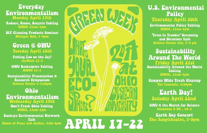
Another successful Green Week was held at the end of the 2017 spring semester:
We have expanded the number of hydration stations on campus with a half-dozen new stations being installed this summer. Most of the new hydration stations are in or around athletic facilities on campus. Athletes have tended to be one of the more significant users of bottled water. Student Dominic Orsini wrote a grant and received funding for promotional water bottles. These will be used to promote the new hydration stations to athletes when they move on campus late this summer.
Nathan Amador will take a group of 12 students to Costa Rica as part of a Travel Learning course. This will be the second time the class will travel to Costa Rica. The students will learn environmental data collection and analysis methods, then implement those methods while in Costa Rica over the semester break (January 2018). Amador and the students are working with Amy Work (OWU ’04) and her Geoporter organization. More info on Amy’s efforts are here.
Again, thanks for all the efforts on what has been a great cross-disciplinary collaboration between faculty, students, staff and alumni over the past five years.
Interested in visiting the tropics? In January? Fall 2017 Travel Course: Geography 347TL: Environmental Alteration, Dr. Amador Rowley
Interested in visiting the tropics? In January?
Fall 2017 OWU Travel Course
Geography 347TL: Environmental Alteration, Dr. Amador Rowley
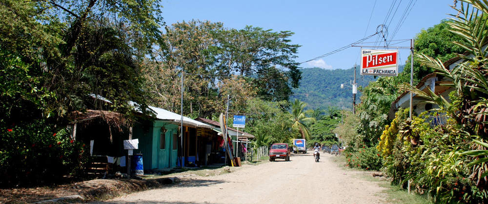
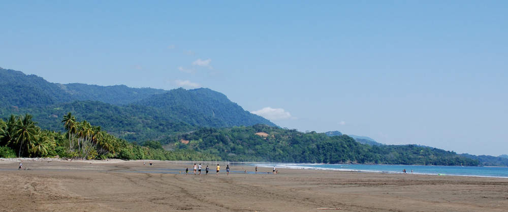
Locations throughout Costa Rica, focusing on a small, coastal town: Bahia Ballena
Assess human impacts on natural environments in Delaware, OH (Fall ‘17) and coastal Costa Rica (Jan. ‘18), putting it into a regional and global context.
Collaborate with Amy Work, OWU Alum (‘04), and her community organization, Geoporter, and work with local citizens in a developing ecotourism region.
Activities Include:
Visiting Palm Oil & Pineapple Plantations
Coffee Plantation
Coastal Community Mapping Using Drone
Biological Nature & Toucan Reserves
Visit Bat Sanctuary
Testing Water Quality
Kayaking through Mangroves
Contact: Dr. Nathan Amador Rowley with any questions (nsamador@owu.edu)
Michael Durfee, OWU 2017, is an Environmental Studies and Medieval Studies dual major, and participated in a summer 2016 master diver apprenticeship in Cozumel, Mexico.
Michael Durfee, OWU 2017, is an Environmental Studies and Medieval Studies dual major, and participated in a summer 2016 master diver apprenticeship in Cozumel, Mexico.
Michael Durfee
October 27, 2016
One of the first lessons we are taught as divers is that we are the stewards, the voice of, and the ambassadors of the underwater world. Nobody else has the means to be so intimate with this environment. Even if for no reason other than we love being in it, we must help protect it.
The Professional Association of Diving Instructors (PADI) stresses the importance of the environment throughout a diver’s training. They teach us how to be careful of sensitive aquatic ecosystems (by maintaining good buoyancy, kicking properly, by knowing we won’t be attacked by animals unless we harass them, or simply by not touching things). PADI provides examples in their training books of ways to be active in the fight to keep our waters healthy.
PADI also advertise and teach Project AWARE both as an independent project and movement and as a specialty course for certification (AWARE Fish Identification, AWARE Shark Conservation, AWARE Underwater Naturalist for example). Project AWARE is the environmental movement within diving, started years ago by PADI and broken off into something grander. AWARE stands for Aquatic World Awareness Responsibility and Education. At its most basic we are given its Ten Ways a Diver Can Protect the Underwater Environment. These are: 1) Dive carefully, 2) Be aware of your body and equipment, 3) Keep your dive skills sharp, 4) Consider your actions, 5) Understand and respect underwater life, 6) Be an Ecotourist, 7) Respect underwater cultural heritage, 8) Report environmental disturbances or destruction, 9) Be a role model, and 10) Get involved.
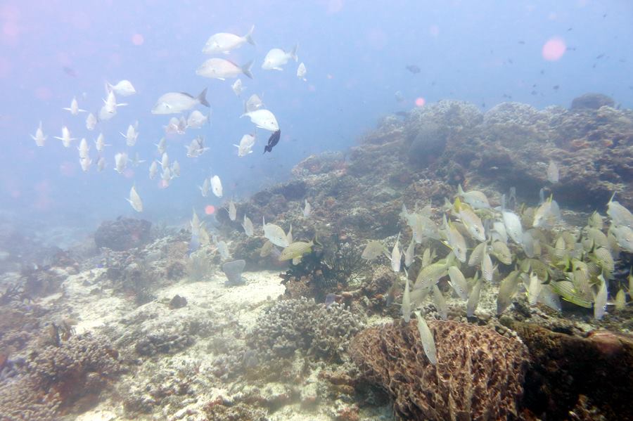
I went to Cozumel, Mexico to earn my PADI Professional Divemaster rating. I chose a very good location for this dive training. Reasons for this are many, but primarily for the fact that the waters surrounding the island are a huge Marine National Park. All divers are required to be extra careful and mindful. For example, nobody is allowed to dive without a local Divemaster. There are extensive, complex coral reefs along the entire west side of the island. There was greater pressure for me to become a better, more skilled diver here. I have confidence in my abilities to observe sensitive organisms without any accidental harm occurring.
Diving these world famous coral reefs was remarkable and eye opening for me. I can hardly express what I have learned. I am familiar with numerous species of fish and am only just beginning to understand how they interconnect to form this ecosystem. I learned how a coral reef works in its most fundamental sense and how nearby wetlands like Mangroves can be essential to the reef’s continued survival.
Simply by observation while in over 60 dives, I got to see how some aquatic animals rely on the health of their coral environment. Health has multiple aspects.
I’ve chosen a few examples.
The sea turtles around Cozumel, most commonly the Green Sea Turtle and the Loggerhead Turtle, depend on coral reefs for food and protection.
The turtles will lie there chomping on coral, digging at it with their beaks. I may postulate that the type of coral matters, which makes the coral and sponge diversity important to the turtles.The relative shallow depths of these reefs allow turtles to live and feed well while still having fairly quick access to the surface for air. Here is a Green Sea Turtle who was eating but is now looking at the diver taking the photo.
Often while I was diving I thought to myself how odd some of the fish I see are. Many seem to be just generic and what a human might expect, but others not so much. Filefish are one of these oddities. I love to wonder why they look like they do – inspiring research on my part.
Watching The fish feed is the biggest clue. Their mouths are specialized for a certain diet. What exactly they eat I do not know, but they use their outwards-pointing teeth and elongated mouth to scrape their food off the bottom and the coral. Being so specialized may indicate an existence more vulnerable to environmental changes. Of the animal species here, it is the oddities, the curiosities and the fantastic that are the first to leave when conditions change.
The Drumfish is one of the most elegant and beautiful species of fish I was ever fortunate enough to observe. They are shy and love to hide under small, shallow ledges. Diversity of structure is one of the most important aspects of coral reef health. In this case, structural diversity allows for the shy to hide their faces and the very shy to hide their entire body. An example of the very shy would include the endemic species to Cozumel, the Splendid Toadfish who hides in a hole day and night.
Another species which appreciates the structural diversity of coral reef systems is the Stonefish, the most poisonous fish in the world.
Stonefish are docile, though, and are named for their ability to blend in with their surroundings and look like a stone or piece of coral. They are one reason why divers in the Caribbean try not to touch the reefs. If we imagine a reef that has been bleached or depleted in its various diversities, a Stonefish would not survive.
There are dozens of animals species which rely on the existence of coral reefs and their diversity. A diver’s awareness of this as connected to their choices and advocacy on land is an essential power. We can help advocate for more Marine National parks and sustainable fishing regulations. We can use sustainably produced products which would not create by-product which ends up in the ocean. We can use sustainable energy sources and/or cut back on overall energy consumption. Our mindful choices have a say in whether these beautiful places and animals will survive.
Having learned in a Marine National Park in Cozumel gave me a heightened sense of my duty as a now Professional diver. My Divemaster training stressed that one of my most essential duties is to be a good role model. This means being a skillful and knowledgeable diver, embracing and adhering to PADI Standards (which keep divers and the environment safe) and embracing and adhering to Project AWARE teachings.
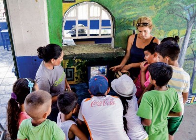
An Ohio Wesleyan alumna, professors, and students are teaming up and using high-tech geography in Costa Rica to help preserve a rich and wonderful ecosystem.
(Photo by Alejandro Orozco)
An Ohio Wesleyan alumna, professors, and students are teaming up and using high-tech geography in Costa Rica to help preserve a rich and wonderful ecosystem.
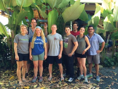
Working with Geoporter’s Amy Work ’04 (far left), the OWU team included (from left) Professor John Krygier, Olivia Lease ’17, Michael Durfee ’17, Christopher Pessell ’18, Luke Steffen ’16, Maddy Coalmer ’18, and Assistant Professor Nathan Amador.
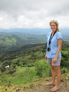
Looking out at the lush, vivid greenery around her simple home in Costa Rica, Amy Work ’04 can scarcely believe her good fortune. The sky is a gorgeous blue, a crystal-clear ocean is nearby, colorful tropical birds swoop overhead, and the sunshine is endless.
It’s a far cry from her growing-up years in Westerville and her college years at Ohio Wesleyan University, where weather tended more toward overcast skies and freezing Midwest winters.
“If you would have told me when I was in college that I’d be living in the tropics and working I would have said you’re joking, there is no way,” Work says. “Now I know that anything’s possible.”
A lofty sentiment, to be sure. But one she believes in so firmly that she’s trying to pass it along to other OWU students by inviting them to visit—and learn—in her little piece of paradise.
Work’s life on the eastern coast of Costa Rica centers on something she was introduced to at Ohio Wesleyan: GIS—geographic information system—technology. In its simplest form, it’s a way to display several sets of data on a single map so users can see and analyze the relationships between each. Accessed through computer software, the technology is used in fields ranging from archaeology to mosquito control to politics—anything that can use location as a factor.
GIS technology was growing in popularity in 2000 when Work was an OWU freshman taking a mapping course taught by geology and geography professor John Krygier.
“That class talked about how maps have helped us understand the world over time, and at the end it talked about GIS,” Work says. A follow-up class taught her the nitty-gritty of GIS and convinced her of its power. By the time she graduated in 2004 with a triple major in geography, urban studies, and environmental studies, she knew she wanted to pursue a career centered on GIS.
Work was sharp, focused, and fully engaged in learning about GIS, Krygier says, especially in upper-level courses where students used the technology to help map potential pathways for future Delaware bike paths. Eventually, Delaware created new paths based on the students’ work.
“She’s one of those people who has a vision and can see the parts needed to make it happen,” Krygier says. “What Amy got in that class was that there’s a tool that can make big, good things happen.”
After graduating from Syracuse University with a master’s degree in geography in 2006, Work became an education and GIS coordinator at the Institute for the Application of Geospatial Technology, or IAGT, in Auburn, New York. Through her work there she met Anita and Roger Palmer, founders of GISetc, a for-profit company that helps educators learn to use GIS in the classroom.
Beginning in 2009, the Palmers began traveling to the Costa Rican coastal village of Bahia Ballena to introduce GIS to community leaders, in the hopes the technology would help the village transition from a farming-and-fishing economy to a tourism economy. When it became obvious the couple’s yearly visits weren’t enough for the project to prosper, they asked Work to live and work there full-time.
That’s what she’s done since August 2012. She’s funded by Geoporter, a nonprofit organization set up by Work, the Palmers, and two Bahia Ballena community members. It’s designed to send educators around the world to do exactly what Work is doing in Costa Rica: solve local issues with GIS. This is Geoporter’s first project.
A hallmark of Geoporter is helping communities help themselves, Work explains. “The community members are the ones who are doing it,” she says. “The community has the goals and the objectives, and the focus is on getting community members to use the technology themselves.”
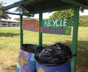
Bahia Ballena leaders decided to tackle trash in the streets with the help of GIS. For a decade, trash had been picked up curbside at homes, but in public places, residents tended to toss it on the ground, Work says. As a result, trash ended up in local streams and then in the ocean, reducing the area’s appeal for tourists.
Work suggested mapping where trash was coming from as a first step. In 2013, she and community members collected trash at specific intervals on the road, counted the kinds of trash found there, and mapped the results using GIS. They found a high concentration of candy wrappers outside grocery stores near schools, for example, from students buying candy on their way home. Soccer fields—popular community gathering spots—had food wrappers and bottles.
“Life in Costa Rica revolves around family, church and soccer, so on Sundays the entire town shows up to watch the games. And there were no trash cans near the soccer fields.” – Amy Work ’04
“Life in Costa Rica revolves around family, church, and soccer, so on Sundays the entire town shows up to watch the games,” Work says. “And there were no trash cans near the soccer fields.”
An analysis of the mapped trash produced action within the year: Trash cans with sections for recyclables and sections for non-recyclables were added where they would reduce the most trash, and an education program encouraged residents to use the cans.
Since then, trash in streams has diminished and more is being recycled—exactly what Geoporter was set up to accomplish.
To spread the word about the success and encourage others to embrace the technology, Work turned to her alma mater. She contacted Krygier, who had first taught her GIS, and his new colleague, Nathanael Amador, and asked: Would Ohio Wesleyan students be interested in working with Geoporter?
The idea jelled when Work returned to the states in 2014 to be inducted into the Ohio Wesleyan Athletic Hall of Fame for her starring role on the Battling Bishops’ national title-winning women’s soccer teams of 2001 and 2002. She talked up her GIS project with Ohio Wesleyan President Rock Jones and by 2015, Amador, with Krygier’s help, was offering a travel-learning course to Costa Rica. Such courses are a core element of The OWU Connection, helping students connect classroom learning with real-world practice in global settings.
“I still feel such a connection to the students at Ohio Wesleyan,” Work says. “I wanted them to see what I’m doing with my degree and to instill in students that you can apply your knowledge to anything and, if you have a passion, follow it.”
The proposal had clicked with Amador, an assistant professor of geology and geography who’d begun working at Ohio Wesleyan in 2014. He was teaching Environmental Alterations, a required class for environmental studies majors, and added the Costa Rica portion as an option for additional class credit.
“What Amy does embodies the point of the course, which is how humans impact the environment,” Amador says. “And it ties together the whole idea of being at Ohio Wesleyan, which is that graduation isn’t the end of your involvement with the University community.”
By December 2015, five students, along with Amador and Krygier, were bumping along the mostly unpaved roads of Costa Rica. Each had completed an environmental project centered on the country before their trip, and their 11-day visit expanded on those projects.
“It’s a good model. Our alumni are spread out all over the world, and I’m hoping other travel-learning courses will take advantage of that.” – John Krygier, professor of geology and geography
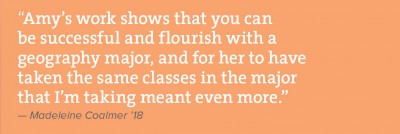
Madeleine Coalmer ’18 examined the effects of ecotourism, global warming, and climate change on water supplies in Costa Rica. She wanted to find out what could be done in the future to reduce yearly water shortages during the dry season. She soon realized that even her use of water at home in Youngstown, Ohio, could ultimately affect the water supply in Central America.
“When my mom picked me up from the airport after the trip, the first thing I told her was I’m going to be more cautious of how much water I’m using,” she says.
Coalmer also learned how much opportunity her chosen major, geography, can provide.
“Amy’s work shows that you can be successful and flourish with a geography major, and for her to have taken the same classes in the major that I’m taking meant even more,” Coalmer says. “It showed me that I could reach out to others and have connections all over the world.”
Chris Pessell ’18 of Cincinnati had studied the impact of African palm-oil plantations on the soil, water, animals, and plants of Costa Rica. African palms were brought to the country after Costa Rica’s banana-growing industry shut down. While they’ve helped the economy, native mangrove forests have been destroyed to make way for the plantations.
Pessell’s view of the industry changed when he visited a plantation on the trip. He realized he’d inflated its harm to the environment.
“I assumed it was like a tree farm, but there was a carpet of plants under the trees and a ton of different bugs,” he says. As long as the plantations aren’t expanding, he says, it doesn’t appear they’ll do additional damage to the environment.
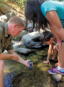
Pessell particularly enjoyed another trip project: testing water in the Bahia Ballena area to ensure clean drinking water is available. After the trip, he helped map the data and hopes to add more as additional testing is done periodically.
“Development has encroached on the amount of water available,” Work says. “We’re mapping the water quality and the stream flow to understand what’s happening and to ensure that our dirty water is taken care of.”
The work cemented Pessell’s plan to pursue a career in water-quality testing when he graduates with his geography major.
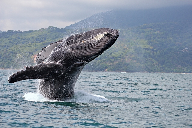
In addition to the palm-oil plantation, students and professors visited two national parks, a bat sanctuary and a pineapple plantation; kayaked through mangrove forests; and took a whale-watching tour (but, unfortunately, saw no whales.)
Interestingly, neither Work nor Amador had opportunities similar to the Costa Rica trip while they were students.
Work’s plans to travel abroad were dashed by 9/11. Instead of traveling, she applied her GIS knowledge on local projects as a student, such as the bike-trail project.
For Amador, plenty of opportunities for study and travel existed at The Ohio State University where he obtained his undergraduate degree, but he had no money to participate.
“I think part of my passion for this is living through the students, letting them take advantage of these opportunities,” he says. “I was interested in getting students to really understand what it means to study this content outside of the classroom and to understand that people are employed doing what you’re learning in this class.”
“We’re mapping the water quality and the stream flow&hellips;to ensure that our dirty water is taken care of.” – Amy Work
The January trip was the second time an Ohio Wesleyan student had visited Work. The first was a year ago, when graduate Christian Gehrke ’15 took a University drone to Bahia Ballena to capture a birds-eye view of the community. The new imagery updated some from 2011 and has a higher resolution. Work will use it to see changes in the environment over time.
“We don’t have the resources to acquire a drone,” she says. “But the student had the technology to help us advance what we’re doing here.”
Krygier hopes the collaboration with Work spurs similar collaborations with OWU alumni.
“It’s a good model,” he says. “Our alumni are spread out all over the world, and I’m hoping other travel-learning courses will take advantage of that.”
In Costa Rica, the link between alumni and OWU continues. Amador visited this summer to take more water samples, and another OWU student took additional aerial photos with a drone.
Work appreciates the extra hands, the equipment and the enthusiasm that students and professors bring to the Geoporter project, but she also sees the collaboration as a way she’s giving back to the University.
“I want to be able to share with students what the University taught me,” she says. “It provided me with the foundation to know that you can learn and do whatever you want to. It shaped me into what I am today.”
Kathy Lynn Gray is a freelance writer from Columbus, OH.
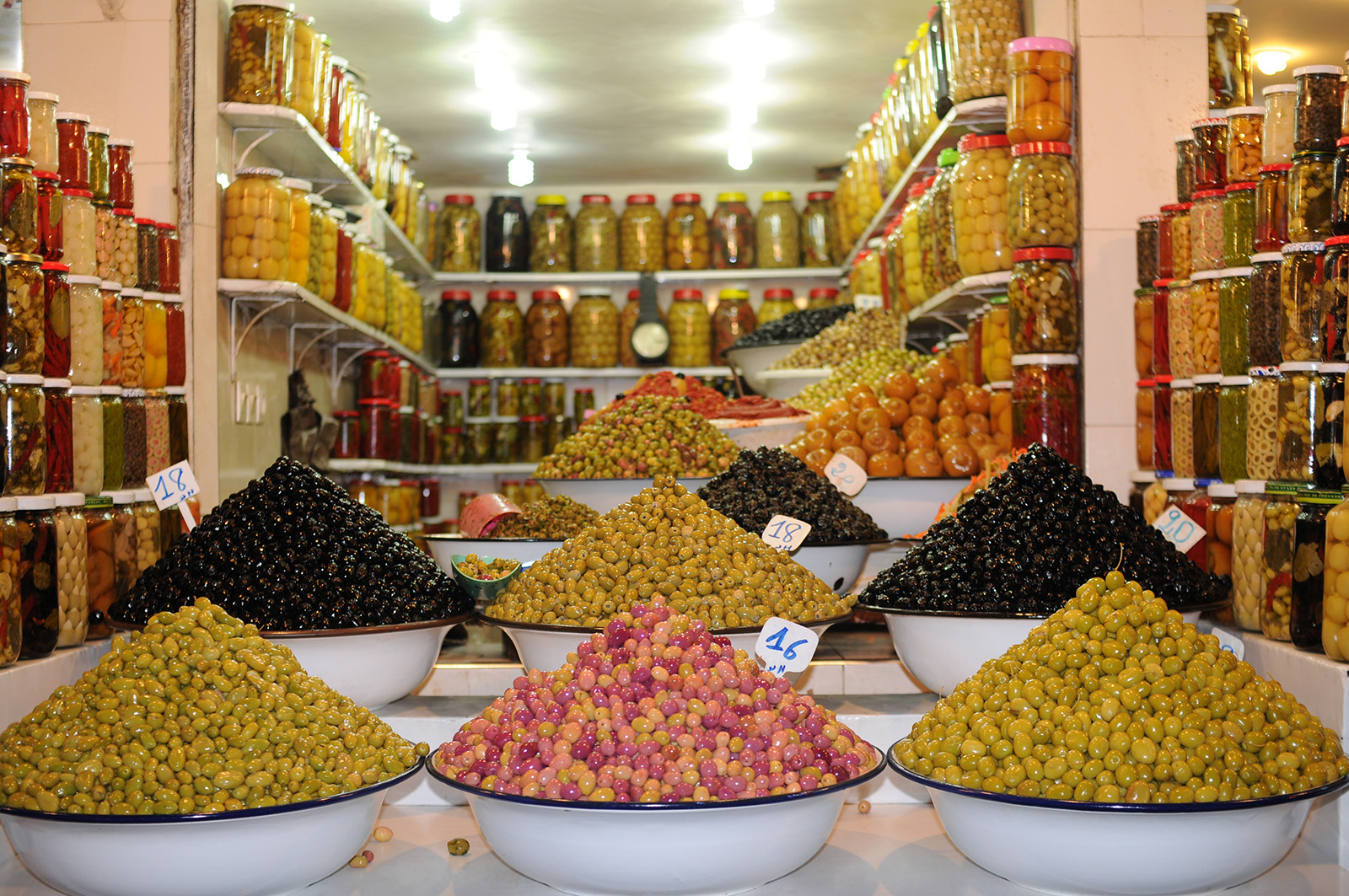
Michael Durfee, an Environmental Studies and Medieval Studies dual major, was awarded an OWU Theory into Practice grant to travel to Morocco during the summer of 2015 to study sustainability and olive agriculture.
Michael Durfee, an Environmental Studies and Medieval Studies dual major, was awarded an OWU Theory into Practice grant to travel to Morocco during the summer of 2015 to study sustainability and olive agriculture.
Olives and Sustainability: A Traditional Setting in Marrakech, Morocco
Objective:
Behind this project lies the theory that traditional ecological and agricultural knowledge and practices are naturally more sustainable and beneficial for the environment and human health. Traditional societies, if we listen, can offer the Western world ways to combat issues with the environment and sustainability. The olive tree and its fruit are hardy and versatile, and Morocco is a place that requires it. The benefits of using olives and their products are endless. Marrakech has been growing olives for hundreds of years and is of great importance in the diet, agriculture and economy of the people. I will investigate the sustainable aspects of the olive and the production and sale of food and trades material as done in a traditional society.
Description:
As negative environmental consequences of human activity become alarmingly evident, sustainable alternatives to current practices grow in importance. Sustainable alternatives are found in traditional communities around the globe. These communities have ingenious approaches to living sustainably, having adapted their strategies to work well with the environment, not against it.
Traditional Ecological Knowledge (TEK) is the collectively owned and shared knowledge of people whose everyday lives depend on and/or support good land stewardship and species and environmental conservation. These people understand firsthand that biodiversity and environmental health are synonymous with human health. TEK can be found in proverbs, folklore, language, local trades, agricultural practices and conservation, dietary choices, commercial purchases and general mindset.
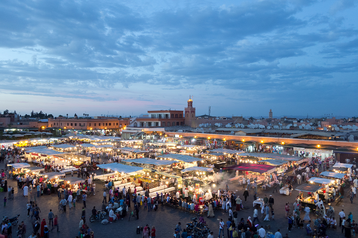
In order to understand the role of TEK in modern sustainability efforts, I will investigate the olive in Morocco. I will explore the practices of olive growing, processing and marketing within their environmental and sustainability context. Morocco’s High Atlas region and the ancient city of Marrakech is a prime region for olive production. My intentions in Marrakech are to trace the environmental impacts of olives and other produce growing, processing, transport to market, and consumption. To document the “farm-to-table” process in a more traditional society, I will visit several urban markets, bazaars and local restaurants in the city and as many olive groves and olive oil mills as possible.
Image: Fresh food markets in the Medina
As traditional knowledge is found throughout a society, I will supplement my focus by investigating local trades like smithies, tanneries, carpet makers, vineyards, and bakeries. I will get my hands dirty volunteering at these places. During two separate two-week periods, I will put theory into practice by living and volunteering at farms, immersing myself in the world of the olive. The first period I will participate in WWOOF (World Wide Opportunities on Organic Farms) at an organic farm near northern Morocco. My stay there is confirmed with the owner. I will determine my second volunteering experience while in Morocco (as the most traditional places have no internet presence) based on contacts I have made in Morocco.
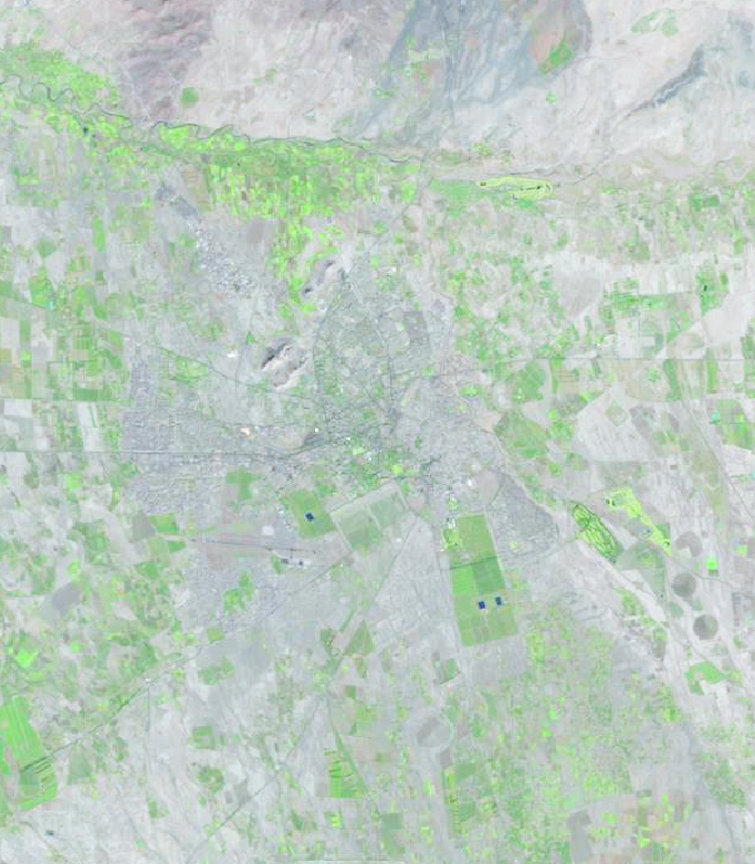
Image: Landsat Satellite Image of Agricultural Areas Surrounding Marrakech, Morocco.
TEK can be found in the Developed World. We find it in Delaware County in small businesses like the Delaware Community Market, Stratford Ecological Center and the Glass Rooster Cannery. Their sustainable methods and are in many ways a reinvention of traditional practices. I plan to compare my experiences in Morocco with practices in central Ohio in order to gain a better understanding of both locations while providing insights into how to better integrate traditional practices in a modern, Western setting.
Travel Learning Course: Geography 347: Environmental Alteration: Comparative Global Environmental Change: Bahia Ballena-Uvita, Costa Rica & Delaware, Ohio. Learn how to collect environmental data in Delaware, Ohio (Fall 2015) and coastal Costa Rica (January 2016) and understand how it relates to regional and global climate and environmental change.
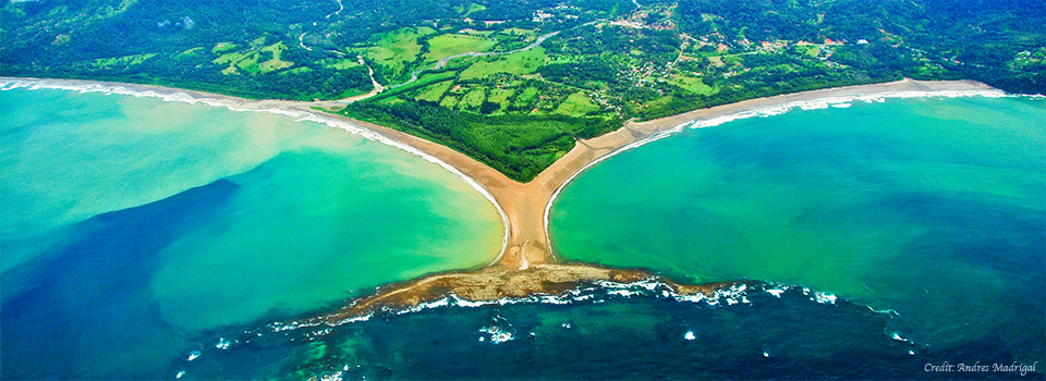
Focus: Comparative Global Environmental Change: Bahia Ballena-Uvita, Costa Rica & Delaware, Ohio
Learn how to collect environmental data in Delaware, Ohio (Fall 2015) and coastal Costa Rica (January 2016) and understand how it relates to regional and global climate and environmental change.
Collaborate with Amy Work (OWU 2004) and her community geography organization, Geoporter, in Bahia Ballena-Uvita. Work with local citizens in a developing ecotourism region
Data: Weather Station | Drone aerial imagery | Ecological assessment Soil moisture & temperature | Steam flow | Water quality | Whale monitoring
Visit: Arenal National Park | Bahia Ballena-Uvita | Eco Surfing | Whale Conservation | Mangrove Conservation | Marino Ballena National Park
Contact: Dr. Nathan Amador (nsamador@owu.edu) & Dr. John Krygier (jbkrygier@owu.edu)
Students need to apply and be pre-approved for this course, prior to registration for fall 2015 courses:
Current Juniors and Returning Seniors April 6, 2015 (7am)
Current Sophomores April 9, 2015 (7am)
Current Freshmen April 13, 2015 (7am)
Details
Global environmental change is among the most important global issues of the next century and central to Geography 347: Environmental Alteration, a core course in Geography and Environmental Studies. The primary objective of Environmental Alteration is to explore the relationship between human and environmental systems from local to global scales. In order to grasp the importance of global environmental change, students need to 1) Understand the importance of scale to differentiate behaviors that modify the landscape (i.e., an individual throwing trash versus tropical deforestation) and their impacts (i.e., local stream pollution versus variability in large-scale precipitation patterns); 2) Understand and practice data collection methods, data analysis and presentation of findings; 3) Understand how research outcomes can affect local, positive changes addressing negative local and global environmental degradation; and 4) Understand the differential impacts of global environmental change by comparing various, worldwide locations, including differences between the Global South (e.g., Costa Rica) and Global North (e.g., the U.S.). The travel component proposed for Geography 347 allows students to effectively engage in all four of these course learning outcomes, building on our Sustainability Region model in Delaware, Ohio and extending it to collaborative work in Costa Rica. The course meets for 3 hours (regular course) + 2 hours (enrichment experience) per week.
The Travel Component:
Drs. Amador and Krygier and students in Geography 347 will travel to and conduct collaborative research in the region around Bahia Ballena-Uvita, Costa Rica.
Students and faculty in our course will be working, before, during and after our travel, with Geoporter, a non-governmental organization (NGO) located in Bahia Ballena-Uvita, Costa Rica. Amy Work, a 2004 OWU Geography Major, manages Geoporter. Amy is well known to members of the Geology & Geography program, has a background in geospatial and environmental education, and provides us with a unique opportunity to develop a long-term collaborative project between her organization and OWU, with the potential for repeated future visits by different courses and faculty. As residents of a costal area in transition from a fishing economy to one based on ecotourism, community members in Bahia Ballena-Uvita are interested in understanding their natural environment and the potential impacts of global environmental change: they share many of the same goals as the Environmental Alteration course. Amy has been working with community members to collect and map environmental information for over several years, providing a solid basis in practice. Geography 347 students will also learn the practice of data collection and mapping (as part of the enrichment component of the course), but also, importantly, develop an understanding of the theories and concepts required to analyze and understand collected data. Theories and concepts will be put into practice in Costa Rica, the collaboration designed so students and community members in Bahia Ballena-Uvita will come to understand both the theory and practice of environmental change at a range of scales.
A fundamental focus of any discussion of human modification of the environment is recognition that the planet is composed of various, dynamically different climate regimes and biomes. A perfect case study is the comparison between environmental alteration and its effects in mid-latitudinal, continental Delaware, Ohio and coastal, tropical Bahia Ballena-Uvita, Costa Rica. Comparison between these two sites will allow us to observe (via various data collection sources) local and global-scale climate impacts on precipitation patterns, temperature variability, and sea level rise. The tropics represent the world’s most biodiverse regions, with Costa Rica accounting for 4% of the world’s known species (~500,000). The region is characterized by a warm, tropical climate and distinct wet and dry seasons. As a result of local and large-scale modification of the environment, the tropics are extremely sensitive to perturbations in the climate system, which generate an amplified response, making it vital to understanding the direct relationships between the human and environmental systems in the tropics.
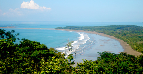
Bahia Ballena-Uvita, on the Pacific Coast, borders Ballena Marine Park, which protects migrating humpback (and other species) of whales. Some of the best-preserved coral reefs in Costa Rica are a short boat ride away at Caño Island Biological Reserve. The coastal mountain chain forms the Path of the Tapir, a vital link in the Mesoamerican Biological Corridor. Nearby are indigenous reserves of the Terraba and Boruca people, and artifacts of their ancestors can be found close to the delta of the Terraba-Sierpe mangroves and wetlands, a protected, internationally recognized site. A little further south, near the town of Golfito, is a tropical fjord called the Golfo Dulce (1 of 4 tropical fjords in the world) with pods of dolphins sometimes numbering in the hundreds.
Specifically, in the Environmental Alteration course, students and Drs. Amador and Krygier will collaborate with Geoporter and its allied community members to collect environmental data on water quality and stream characteristics, temperature, and rainfall. Additional weather variables will be collected by Dr. Amador’s professional weather station (which will be used in both locations). We will acquire an array of various open source (e.g., free) geospatial data sets, including digital maps, remote sensing (satellite and at-site drone reconnaissance with Geology & Geography’s imaging drone) to monitor environmental conditions (such as meteorological and land use/land cover). These primary data sets will allow the students to assess the impacts of human behavior on the local environment, and to generate suggestions for local-scale changes and mitigation.
Impact of the Travel Component of Geography 347
Amy Work (OWU 2004) and Geoporter have over five years of experience and engagement with Bahia Ballena-Uvita and other regional communities, collecting and analyzing data and affecting community change with a focus on the environment. Before, during and after the course visit to Costa Rica, Drs. Amador and Krygier, Amy Work, students and community members will develop an expanded program of data collection and analysis, focused on the local impacts of global environmental change (with a focus on the locations in Ohio and Costa Rica). This expanded program meets the needs of both Geography 347 and community and Geoporter needs in Costa Rica. Bahia Ballena-Uvita provides an excellent opportunity for travel and engagement, given the rich ecosystem, economic importance of the environment for the future of the community, relevance to the study of local impacts on environmental change, and substantive connections (through Amy Work and Geoporter). Collaboration between participants in Costa Rica and OWU will occur through online, cloud-based GIS software, before, during, and after the travel. Each student will develop a focused course project that will reflect the four course objectives (outlined above). As a result of the students’ travel-learning experience, they will represent the University’s mission by applying course theory to a real-world problem, understanding the importance of citizenship and their ability to contribute to a global society.
Additional Experiences for Students in the Travel Learning Component of the Course:
Several themes will be covered in the Environmental Alterations course for all students, including how humans impact the hydrologic cycle and the global energy balance. Throughout the course, we will assess how humans are involved in altering the local environment (in Delaware, Ohio) with a focus on local data collection here at “home.” Methods learned in Delaware serve as training for data collection in Bahia Ballena-Uvita, Costa Rica, where students will share what they know and co-collect data with community members. Amy Work and Bahia Ballena-Uvita community members will collect some environmental data before the course visit. Before, during and after the visit to Costa Rica, the students will do comparative analysis of the two study sites, using the available data (collected prior, and during the visits). We hypothesize that this approach will allow students to more clearly understand the differential environmental impacts of global climate change and the distinct difference in the response to global environmental change in the Global North and Global South. We believe that some of the students who travel to Costa Rica will wish to continue work on the project, in independent study projects.
The .25 credit enrichment experience will focus on learning the techniques and methods of environmental data collection, mapping and analysis required for the Costa Rica experience but also for the broader goal of comparing and understanding the effects of global environmental change. It is feasible to teach these techniques to a class of 12, but not 35-40 (the typical enrollment of Geography 347). We will, as part of the enrichment experience, investigate how local ecosystems (such as streams) are impacted by humans, by collecting in-situ data, both in Delaware, Ohio (and later in Bahia Ballena-Uvita) on water quality, stream discharge, and stream pollution (due to surface runoff and trash infiltration). Techniques of collecting weather data (temperature, precipitation, etc.) will also be covered. We will “scale up” the research questions to investigate large-scale impacts humans have on the hydrologic system by using satellite imagery to detect variability in sea surface temperature (SST; applicable to tourism and whale watching), precipitation, and air surface temperature patterns. Additionally, we will investigate the effects of large-scale land-use land-cover (LULC) change, primarily through satellite and drone-acquired imagery. Insights from the enrichment experience will be used in the regular Geography 347 course.
Instruments for collecting data will be funded by various sources, including Dr. Amador’s start-up research funds, the Department of Geology and Geography, and Ohio Wesleyan University. We are requesting funds from the Travel Learning grant for relatively inexpensive instruments and equipment that will be used during our proposed course and left with Amy Work and Geoporter to continue collaborative data collection after the visit.
Weather Station: Includes measurements for air temperature, relative humidity, precipitation, barometric pressure, solar radiation and wind speed/direction (already acquired with Dr. Amador’s start-up funds)
A data logger and set of temperature and soil moisture probes (will be acquired with Dr. Amador’s start up-funds.).
A set of 24 thermometers ($6/each) and 24 rain gauges ($5/each), where half will be used in data collection at each site location (Delaware and Bahia Ballena-Uvita). The thermometers and rain gauges will be calibrated against the weather station data for accuracy and precision (we are requesting funds for these devices).
We will use a stream flowmeter ($249.95) to monitor stream velocity and changes in discharge over time. Changes in streamflow are a direct result of precipitation rates, changes in upstream surface runoff (i.e., paving roads), and can help indicate changes in erosion rates through sediment transport through the stream (we are requesting funds for this device).
In order to measure the water quality of nearby streams, we will use a comprehensive water quality testing kit ($398.95) and an additional refill for added samples ($112.95) for each of the two sites. The variables measured include: pH, nitrate-nitrogen, phosphate, dissolved oxygen, total alkalinity, turbidity, and temperature (we are requesting funds for this device).
For data notation, the data collectors will need appropriate, all-weather data notation notepads ($9/each) to record observations and notes during instrument installment and data collection periods (we are requesting funds for these items).
Together, we have collected a list of primary objectives that include data collection, analysis and problem solving, which can be accomplished between the facilitators (Drs. Amador and Krygier, and Amy Work), the community (residents of Bahia Ballena-Uvita), and the OWU students enrolled in the travel-learning course. Communication and pre-planning between the two sites (Delaware, Ohio and Bahia Ballena-Uvita, Costa Rica) will provide for a well-organized and mindful trip, which will lead to a better experience for all involved. The traditional Geography 347 course will meet Tuesday and Thursday between 1:10 – 3:00 pm, with the Travel-Learning component taking place (as a separate course) Tuesday and Thursday 3:00 – 4:00 pm.
Poverty, Equity, Social Justice Course Connect Spring Lecture
“The Real Utopias of Argentina” Visiting Worker Cooperatives and Sustainable Farms on a Travel Learning Course.
Paul S. Dean, Assistant Professor of Sociology / Anthropology. Wednesday, March 18 at noon, Corns 312
Poverty, Equity, Social Justice Course Connect Spring Lecture
“The Real Utopias of Argentina” Visiting Worker Cooperatives and Sustainable Farms on a Travel Learning Course.
Paul S. Dean, Assistant Professor of Sociology / Anthropology. Wednesday, March 18 at noon, Corns 312
The purpose of PESJ is sharing information, analysis about the impact of poverty, (in)equity & social justice, locally, nationally & globally. A sense of what social remedies and activism may reduce these disparities. Free and open to the public. OWU Sponsoring Organization/Office: PESJ Course Connection. Contact: Pam Laucher at jcdurst@owu.edu.


 The turtles will lie there chomping on coral, digging at it with their beaks. I may postulate that the type of coral matters, which makes the coral and sponge diversity important to the turtles.The relative shallow depths of these reefs allow turtles to live and feed well while still having fairly quick access to the surface for air. Here is a Green Sea Turtle who was eating but is now looking at the diver taking the photo.
 The Drumfish is one of the most elegant and beautiful species of fish I was ever fortunate enough to observe. They are shy and love to hide under small, shallow ledges. Diversity of structure is one of the most important aspects of coral reef health. In this case, structural diversity allows for the shy to hide their faces and the very shy to hide their entire body. An example of the very shy would include the endemic species to Cozumel, the Splendid Toadfish who hides in a hole day and night.